Stormy Sunday: Hail and Severe Thunderstorms Grip the Houston Metro
Wet and Tumultuous Start to the Weekend Finish
Houston residents are waking up to a soggy and unpredictable Sunday, March 8, 2026. After a relatively warm stretch, the weather has taken a sharp turn as a complex system moves through Southeast Texas. Meteorologists are tracking widespread rain and severe storm potential that will likely dominate the local headlines throughout the day. With humidity levels reaching a staggering 94%, the air feels heavy and ripe for atmospheric instability.
Morning and Afternoon: Damp and Muggy
The early morning hours began with light to moderate rain, and conditions are expected to remain damp through the midday period. Temperatures today will stay within a relatively tight but warm range, with a projected high reaching between 77°F and 82°F. Despite the cloud cover, the humidity will keep things feeling much warmer, with heat indices potentially reaching the mid-70s even during rain spells.
- Morning: High probability of showers (approx. 75-80% chance) with overcast skies and light easterly winds at 5 to 10 mph.
- Afternoon: Temperatures will peak near 82°F. While scattered breaks in the rain are possible, the atmosphere will remain unstable, setting the stage for more intense activity later in the day.
- Humidity: Residents should expect levels to hover around 86% for most of the daylight hours.
Evening Alert: Severe Weather and Hail Threat
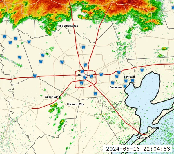
The primary concern for Houstonians occurs as the sun begins to set. The National Weather Service has officially issued a Severe Thunderstorm Watch for the Houston area, effective until 11:00 PM tonight. This system brings the risk of more than just a standard rainfall. A specific hail alert has been issued, warning that storms could produce hail up to the size of quarters.
In addition to the hail threat, localized damaging wind gusts of up to 70 mph are possible. These straight-line winds can be just as dangerous as isolated tornadoes, which meteorologists are also monitoring closely as the line of storms pushes through the region. Rainfall totals could reach significant levels in short bursts, leading to localized street flooding in low-lying areas or neighborhoods with poor drainage.
Impacts on Local Events
The inclement weather has already forced changes to major local attractions. Officials at RodeoHouston have announced the cancellation of the nightly drone show at NRG Park due to safety concerns regarding the approaching storms. Attendees were asked to seek shelter early this evening as the most intense cells began their approach. With a low tonight of 69°F and continued scattered thunderstorms into the overnight hours, residents are advised to keep their weather alerts active and avoid unnecessary travel during heavy downpours.

Discovery Green schedules four days of FUNomenal Spring Break activities and cultural performances in downtown Houston

Wrong-way crash on Highway 6 North near Clay Road leaves one dead and two injured
Houston forecast: Rain tapers after weekend storms as a stronger system targets Wednesday across the region