Houston forecast: Rain tapers after weekend storms as a stronger system targets Wednesday across the region
Rain exits, then a midweek cold front could renew storm and flooding concerns
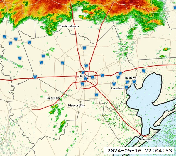
Houston is transitioning out of a wet, stormy weekend as a lingering boundary near the Gulf Coast gradually loses influence early this week. Forecast guidance indicates the pattern will remain unsettled at times Monday and Tuesday, with intermittent showers possible, before a more organized storm system arrives around Wednesday.
The weekend setup featured Gulf moisture interacting with a slow-moving front, a combination that can promote repeated rounds of rain. In early-week analyses, forecasters continued to flag the Gulf Coast for pockets of heavier rain where thunderstorms persist, even as the overall threat shifts away from the Houston area.
What to expect Monday and Tuesday
In the near term, the Houston metro is expected to see a break from widespread downpours, but not a complete shutoff of rain chances. Warm, humid air remains in place, and passing showers or brief thunderstorms can still develop, especially during periods of higher moisture and lift. That means some neighborhoods may see little to no rain while others pick up quick bursts capable of producing brief street ponding.
- Rain coverage: generally lower than the weekend, but not zero
- Storm character: hit-or-miss showers and isolated thunderstorms
- Primary impacts: brief heavy rain and localized ponding in poor-drainage areas
Wednesday: the next organized storm threat
By Wednesday, a quicker-moving, more potent system is expected to sweep through Southeast Texas, bringing a renewed risk of strong thunderstorms. Forecast discussions for the Houston area emphasize that the highest potential for stronger storms may focus on the northern side of the metro, a common outcome when upper-level support and the strongest wind fields track north of the coastline.
This midweek system is also expected to be tied to a stronger cold front. As it passes, it should push humidity out of the region and introduce a cooler, drier air mass for the latter half of the week. Even with that improvement after frontal passage, the front’s arrival can briefly increase storm intensity by sharpening temperature and wind contrasts along the boundary.
Forecast confidence is typically higher on the arrival of the front than on neighborhood-level rainfall totals, which can vary sharply depending on storm placement.
Key takeaways for planning
- Expect improving conditions after the weekend rain, with only scattered showers early week.
- Plan for a higher-impact weather day Wednesday, including the possibility of strong storms.
- After the front, conditions should turn less humid and more seasonable heading into late week.
As timing and storm intensity become clearer, updates to short-term forecasts and any watches or warnings will refine the midweek risk, particularly for areas prone to rapid runoff and street flooding.

Discovery Green schedules four days of FUNomenal Spring Break activities and cultural performances in downtown Houston

Wrong-way crash on Highway 6 North near Clay Road leaves one dead and two injured