Tornado watch covers Houston and Southeast Texas until 9 p.m. Saturday as storms move east
Tornado watch issued as a cold front approaches
A tornado watch is in effect for Houston and parts of Southeast Texas through Saturday evening, Feb. 14, 2026, as a line of thunderstorms develops ahead of an advancing cold front. The watch signals that atmospheric conditions could support tornado formation, even if no tornado has been confirmed.
Forecast guidance indicates storms are expected to intensify as they track west-to-east across the region. The highest-impact window for the Houston metro is projected for the early-to-mid evening, with storms then shifting toward the coast and moving offshore overnight into early Sunday.
What the watch means, and what it does not
A tornado watch differs from a tornado warning. A watch is issued when ingredients for severe weather, including tornadoes, are present across a broad area and time window. A warning is issued when a tornado is indicated by radar or confirmed by observation and requires immediate protective action.
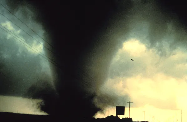
In this event, forecasters have emphasized that a widespread tornado outbreak is not expected, but isolated, short-lived tornadoes are possible within stronger storm segments. The primary hazards are expected to include damaging straight-line winds and hail, with heavy downpours capable of producing localized street flooding where storms repeatedly move over the same locations.
Primary hazards and timing expectations
- Damaging winds: potential for gusts in the 60–70 mph range in the strongest storms.
- Hail: some storms may produce hail around quarter size.
- Localized flooding: brief, intense rainfall may overwhelm drainage in spots, especially in low-lying or poor-drainage areas.
- Tornado potential: low overall, but not zero; brief spin-ups can occur within fast-moving lines of storms.
Storms are expected to reach parts of the Houston area in the evening hours, with the most significant weather risk concentrated before the watch expires Saturday night.
Preparedness: where to shelter if warnings are issued
Residents are advised to ensure they can receive emergency alerts and to identify a safe place before storms arrive. The recommended shelter location is a basement or storm shelter when available. In homes without basements—common across Southeast Texas—an interior room on the lowest level, such as a closet or bathroom, is generally considered safer than rooms with windows.
Key point: a tornado watch is a preparedness signal. Move to action if a tornado warning is issued for your area.
Broader regional context
The storm system affecting Southeast Texas is part of a larger pattern producing strong to severe thunderstorms across parts of the state and the broader Gulf Coast region this weekend. The threat level varies by location, but the Houston metro remains within the corridor where severe storms are considered possible through Saturday night.
Conditions are expected to improve after the storms move offshore, with a drier, cooler air mass following behind the front into Sunday.