Storm Sirens and Humidity: A Volatile Saturday Ahead for Houston
Morning: A Humid Start with Foggy Horizons
Houstonians waking up this Saturday, March 7, 2026, will be greeted by a heavy, humid atmosphere. The day begins with temperatures hovering around a mild 72°F and humidity levels reaching a staggering 88%. For those near the coast and Galveston Bay, patchy sea fog is expected to linger through the early hours, potentially impacting morning commutes and outdoor plans. While the early morning remains mostly dry with just a 19% chance of rain, the stagnant, warm air is a precursor to the significant atmospheric shift arriving later today.
Afternoon: Rising Heat and the Severe Weather Window
As we head into the afternoon, temperatures are forecast to climb to a peak of 85°F. While the first half of the day may see some sun, cloud cover will thicken rapidly as a cold front approaches from the northwest. Meteorologists have identified a critical window for severe weather development. Residents in northern and western communities, such as Huntsville and Brenham, should be alert by early to mid-afternoon. For the Houston metro area, the highest risk for storm development falls between 3:00 p.m. and 6:00 p.m. as daytime heating maximizes atmospheric instability.
Evening: Weather Impact Alert and Heavy Thunderstorms
A Weather Impact Alert is officially in effect for Saturday evening and tonight. As the line of storms moves through, the probability of precipitation jumps to 85%. Communities closer to the coast, including Galveston and High Island, are likely to see the brunt of the activity between 5:00 p.m. and 8:00 p.m. before the system pushes offshore late tonight. Overnight lows will remain steady near 72°F, but the environment will be dominated by frequent lightning and heavy downpours.
Warnings and Safety Hazards
The National Weather Service has placed most of Southeast Texas under a Slight Risk (Level 2 of 5) for severe thunderstorms. Residents should prepare for the following hazards:
- Damaging Winds: Straight-line wind gusts could reach 60 to 70 mph, capable of downed trees and power outages.
- Large Hail: There is a distinct possibility of hail, particularly in areas northwest of the city.
- Flooding: A Slight Risk for excessive rainfall is in place, especially for areas along and north of I-10. Isolated totals of 2 to 4 inches could lead to street ponding and minor urban flooding.
- Tornado Threat: While the primary threat is wind, a brief, isolated tornado cannot be ruled out as the line of storms organizes.
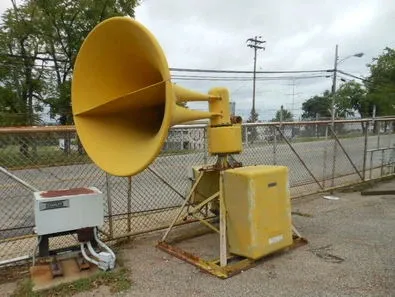
The houston.news team advises all residents to stay weather-aware, secure outdoor furniture, and have a way to receive emergency alerts throughout the evening.
Diamonds, Dust, and Storm Clouds: The Saturday Morning Briefing

Heavy Rodeo Crowds and Major Weekend Closures on I-10 and I-45

Preliminary federal report details de-icing timeline, flight data in fatal jet crash tied to Houston firm