Spring Sizzle Arrives Early: Houston Hits the 80s This Monday
Monday’s Outlook: A Warm Start to the Work Week
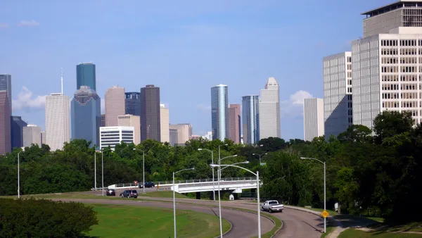
Houstonians waking up this Monday, March 2, 2026, can expect a day that feels more like mid-May than early March. As the city settles into the first week of the new month, a surge of unseasonably warm air is pushing temperatures well above the historical average. While the morning may start with a gray and damp feel, the afternoon promises plenty of opportunities for outdoor activities before an unsettled weather pattern moves in later this week.
Morning: Cloudy Starts and Patchy Fog
The day begins with a thick blanket of cloud cover across the Greater Houston area. According to the National Weather Service, residents should prepare for patchy to areas of dense fog during the early morning commute, particularly in low-lying areas and along the coastal plain. Temperatures will start in the low to mid-60s, with a forecast low of approximately 64°F. Humidity levels will be high, hovering near 96% to 98% during the sunrise hours, making the air feel heavy and damp. If you are heading out early, allow for extra travel time as visibility may be reduced on major thoroughfares like I-45 and the 610 Loop.
Afternoon: Breaking Into the 80s
As the sun climbs higher, the morning clouds are expected to thin out, giving way to partly sunny skies by midday. This transition will trigger a rapid rise in mercury. For Monday afternoon, inland Houston is forecasted to reach a high of 81°F to 82°F, which is nearly 10 degrees above the seasonal norm. While inland areas sizzle, those heading toward the Gulf Coast will enjoy slightly milder conditions, with highs at the beaches remaining in the mid-70s. Despite the warmth, the chance of rain during the daylight hours remains very low, at only around 5%, making it an ideal window for errands or lunch on a patio.
Evening and Night: Clouds Return with a Slight Chill
As the sun sets, cloud cover will begin to increase once again. The evening will remain mild, with temperatures slowly dipping back into the upper 60s. By late tonight, there is a minor increase in the chance of precipitation, with a 10% to 20% possibility of light rain or isolated drizzles developing after midnight. Overnight lows are expected to settle around 62°F to 64°F under mostly cloudy skies.
Drought Update and Safety Notices
Currently, there are no active wind or rain warnings for Harris County or the surrounding Southeast Texas region. However, meteorologists remind residents that the majority of the region remains under severe to extreme drought conditions. While the lack of rain today is great for commuters, the dry spell continues to impact local vegetation. Beneficial rain is not expected to arrive in significant amounts until midweek, starting Wednesday, when a more active weather pattern featuring scattered thunderstorms is predicted to take hold.
Warm Breezes and Near-Record Highs Sweep Into Houston

No. 7 Houston rallies past Baylor 77-64 on Senior Night, forcing 18 turnovers at Fertitta Center

Harris County judge Republican primary appears headed to runoff as Sanchez leads and Lancton falls short