Houston’s planned 14-mile World Cup Green Corridor links transit and trails between EaDo and NRG Stadium
A transportation-and-public-space loop built around existing infrastructure
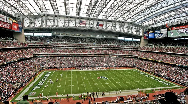
Houston’s World Cup host planning includes a “Green Corridor” described as a 14-mile loop designed to connect two major tournament focal points: the FIFA Fan Festival site in East Downtown (EaDo), near Shell Energy Stadium, and NRG Stadium, where Houston is scheduled to stage seven 2026 FIFA World Cup matches.
The corridor concept centers on moving visitors and residents between venues using established METRORail service and the city’s hike-and-bike network, with the stated goal of offering a lower-emissions, more walkable way to circulate through several central neighborhoods during the tournament period. The loop is framed as an access strategy as well as a public-realm project intended to remain usable after the World Cup.
How the corridor is intended to function during the tournament
Event timelines place the FIFA Fan Festival in EaDo from June 11 through July 19, 2026, spanning most of the tournament. Match play at NRG Stadium is scheduled to begin June 14, 2026, creating overlapping days in which large crowds could move between the fan zone, downtown activity centers, and the stadium complex.
Regional transit preparations have included plans for intensified METRORail and bus operations during the World Cup window. The Red Line is positioned as a key spine for accessing NRG Stadium, while the overall service plan outlines expanded frequencies, longer operating hours, and additional connections intended to manage peak demand.
- Primary connection: rail-and-trail movement between EaDo’s Fan Festival footprint and NRG Stadium
- Neighborhood reach: Downtown, Midtown, Museum District, Third Ward and EaDo are included in the corridor description
- Operational focus: increased transit capacity and hours during the tournament period
Heat mitigation and wayfinding as practical design requirements
Planning materials for the corridor concept emphasize visitor comfort and safety in summer conditions. Proposed elements include shade strategies, cooling features such as misting stations, and free access to drinking water at clearly marked areas. The corridor framework also highlights the need for accessible routes and wayfinding to guide movement between transit stops, trails, public spaces, and event sites.
The corridor concept is presented as both a visitor-experience project and a resilience-oriented public-space improvement for residents.
Related permanent projects shaping the same movement network
Separate from the corridor loop, downtown is advancing a permanent pedestrianization project along Main Street. The Main Street Promenade plan calls for closing north- and southbound vehicle lanes for seven blocks between Commerce and Rusk while keeping cross streets open, with construction funding described at $14 million. Together with underpass lighting and other streetscape upgrades already underway in the urban core, these projects align with the broader objective of making central Houston easier to navigate on foot and by transit.
Funding and legacy framing
The Green Corridor has also been tied to legacy programs that pair event readiness with longer-term civic initiatives, including school-based sustainability projects and community engagement components designed to continue beyond 2026. Private investment has been publicly associated with corridor-related green infrastructure, alongside host-committee planning that treats the loop as an enduring addition to Houston’s mobility and public-space network rather than a temporary event overlay.