Houston Association of Realtors halts plan to show flood-risk ratings on Texas home listings
Flood transparency proposal paused after internal concerns over accuracy and market effects
The Houston Association of Realtors (HAR), which operates one of the region’s most-used home-search platforms, has dropped plans to place flood-risk ratings directly on individual property listings, reversing a multi-year effort that had been nearing launch. The decision follows extended internal debate among real estate professionals over how flood modeling should be displayed and interpreted during home searches.
The initiative centered on integrating property-level hazard analytics into the listing experience so prospective buyers could see an estimated flood risk while browsing homes. HAR had worked with researchers affiliated with Texas A&M University’s Institute for a Disaster Resilient Texas on a tool known as Buyers Aware, designed to generate a structured risk assessment for specific addresses in areas impacted by Hurricane Harvey.
What will and will not change for buyers
HAR’s decision means flood-risk ratings will not appear as a standard element on each listing page. However, Buyers Aware remains available as a standalone resource, and HAR continues to direct consumers to flood-related information through a dedicated flood information page that also references other mapping and risk tools used in real estate due diligence.
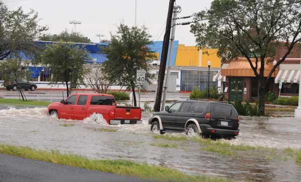
For homebuyers, the practical effect is that flood risk will remain something they must actively research rather than passively encounter while scrolling listings. That research often involves comparing multiple sources that measure different things—such as floodplain location, modeled rainfall flooding, riverine flooding, and historical loss signals—each of which can yield different conclusions depending on method and geographic resolution.
Why members raised objections
Realtors and brokers voiced concerns that a single score displayed prominently on listings could be misunderstood as an official determination of insurability or a definitive engineering conclusion. Another issue raised internally was that some risk ratings can reflect land-based exposure rather than the flood performance of a particular structure, which may vary significantly if a home has been elevated or otherwise mitigated.
HAR leaders also faced questions about how to balance competing risk estimates if multiple models produce different results for the same address. Some members argued that highlighting one estimate could create inconsistent outcomes across neighborhoods and property types, particularly in a market where flood perception can influence financing, insurance shopping, and buyer interest.
How flood disclosure works in Texas
Texas requires sellers of residential property to provide a disclosure notice that includes flood-related information, including whether the seller is aware of previous water penetration from a natural flood event and whether the property is located wholly or partly in mapped floodplains, floodways, flood pools, or reservoirs. Separate disclosure requirements also apply in certain landlord-tenant situations.
Those disclosures, however, are not the same as forward-looking risk estimates. Flood models attempt to quantify the probability and potential severity of future flooding, while disclosure forms focus on known history and mapped regulatory designations.
Key flood-risk checks buyers still use
- Review the seller’s disclosure notice for flooding history and floodplain indicators
- Check FEMA flood maps and local flood control district mapping tools
- Request flood insurance quotes early to understand cost and eligibility
- Ask for an elevation certificate when available
- Look for physical signs of prior flooding during showings (e.g., water lines in garages)
With the listing-integration plan paused, flood-risk information remains available, but it is less centralized in the home-search process.
HAR has indicated the topic could be revisited. For now, the organization’s decision leaves Texas home listings largely unchanged while keeping flood-risk tools accessible through separate channels.