Brace for the Shift: Warm Morning Gives Way to Afternoon Storms and a Coastal Cold Front
A Tale of Two Climates
Houstonians waking up this Tuesday, February 3, 2026, will find themselves in the midst of a significant weather transition. While the day begins with unseasonably warm temperatures and a touch of coastal humidity, a potent cold front is currently tracking toward the metro area. This atmospheric shift is expected to bring a cocktail of patchy fog, midday showers, and potentially vocal thunderstorms by this evening. As the lead editor for houston.news, I advise residents to keep both their sunglasses and their umbrellas within reach, as the conditions at sunrise will look very different from those at sunset.
Morning: Fog and Mild Conditions
The morning hours will start on a mild note, with temperatures hovering in the low 60s and climbing quickly toward a daytime high between 68°F and 75°F. Early commuters should be wary of patchy sea fog, which is likely to roll in ahead of the approaching front, potentially reducing visibility on major thoroughfares like I-45 and the 610 Loop. Humidity levels will remain high, near 86%, making the air feel thick before the front arrives to sweep it away. Expect mostly cloudy skies through the noon hour with only a slight 30% chance of isolated light rain.
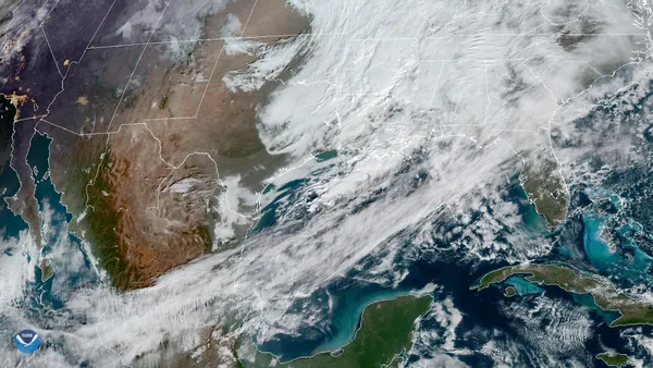
Afternoon: The Arrival of the Front
By mid-afternoon, the weather pattern begins to destabilize. Forecast models indicate a 60% chance of showers as the cold front moves into the region from the northwest. Winds, which will start the day coming from the south-southwest at approximately 11 mph, are expected to shift and become gustier as the frontal boundary nears. This is the period when most residents will want to transition their outdoor plans indoors. While widespread flooding is not currently anticipated, localized heavy downpours could lead to ponding on the roads during the peak of the afternoon rush.
Evening and Overnight: Storms and a Sharp Chill
The most active weather is slated for the evening and overnight hours. Rain chances jump to 70% as the front pushes toward the coast, bringing the possibility of thunderstorms. These storms are expected to clear out much of the lingering humidity, but they will leave much colder air in their wake. By late tonight, temperatures are forecast to plummet into the upper 30s for northern suburbs and the low 50s closer to the Gulf. The sky is expected to clear rapidly after midnight, leading into a much cooler and sunnier Wednesday.
Daily Weather Summary
- High Temperature: 68°F to 75°F
- Low Temperature: 38°F (North) to 52°F (Coast)
- Rain Chance: 60% afternoon; 70% evening
- Wind: South-southwest 10-15 mph, gusting higher during frontal passage
- Alerts: Patchy sea fog advisory for the morning; cold front arrival late afternoon